MT @rdtvan: Bing re-imagines #downtownVancouver http://t.co/W4h9TXU8Vx #rdtvan http://t.co/ioZirDl557 pic.twitter.com/dipdZwWywm
— Bing Thom Architects (@BTArchitects) July 4, 2015

Showing posts with label Urban Renewal. Show all posts
Showing posts with label Urban Renewal. Show all posts
Saturday, July 4, 2015
Bing Thom re-imagines downtown Vancouver

Saturday, May 16, 2015
From The Guardian —The Liverpool street that might win the Turner prize
 |
Cairns St. Assemble helped to transform after ‘managed decline’. A Teebay/Liverpool Echo
|
Toxteth then and now: photographs of a bygone Liverpool http://t.co/SAcpix9PYF pic.twitter.com/YzUPEpweKS
— Guardian Cities (@guardiancities) May 19, 2015Monday, April 20, 2015
From The Atlantic — Nice Downtowns:
How Did They Get That Way? "It wasn't easy"

Wednesday, January 28, 2015
Tuesday, January 13, 2015
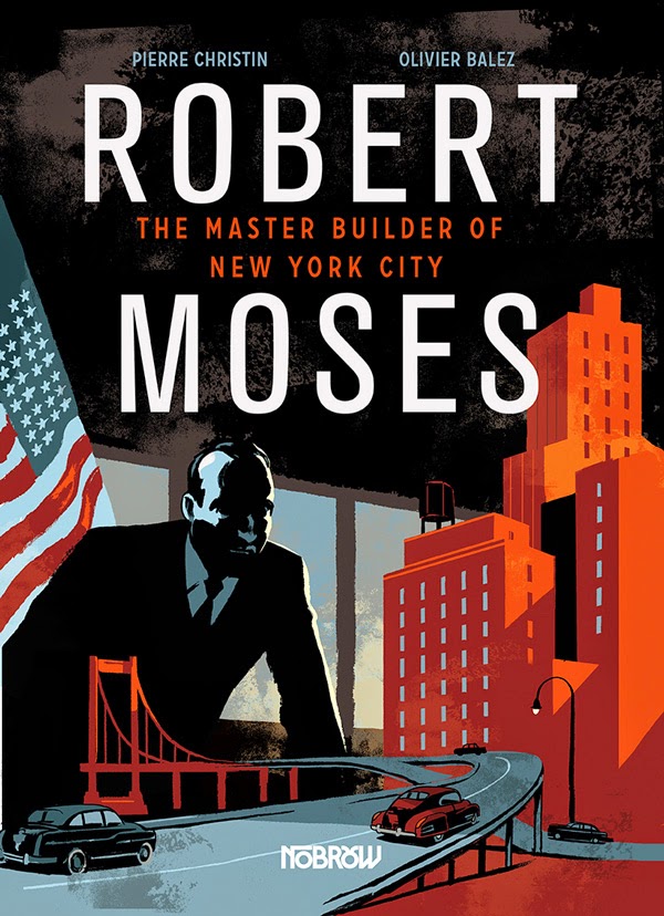
From Brain Pickings — A Love Letter
to Jane Jacobs, Tucked Inside a
Graphic Biography of Robert Moses
Monday, May 19, 2014
Growing An Urban Neighborhood, One Store At A Time @NPR @VibrantStreets
Growing An Urban Neighborhood, One Store At A Time @NPR @VibrantStreets http://t.co/M0TMkcVRxT
— TheSidewalkBallet (@1sidewalkballet) May 19, 2014

Tuesday, May 13, 2014
Knight Foundation, Centre for the Living City Sponsor English Translation of
Jaime Lerner's Urban Acupuncture

Monday, April 14, 2014
From Bloomberg Businessweek —
Cities Haunted by Too Many Parking Spaces

Offering developers tax incentives and zoning changes, officials are seeking to remove parking facilities in favor of projects that will draw more revenue, while making their communities friendlier to pedestrians as people eschew cars. Read more: Parking Lots Demolished in Cities’ Revenue Bid as Driving Wanes - Businessweek
Wednesday, February 19, 2014
From Urban Land Magazine —
Keeping an Urban Authenticity Alive:
Vancouver's Granville Island

Friday, January 17, 2014
Financing Urban Growth: The Use of Development Cost Charges and Community Amenity Contributions @CS_SFU http://t.co/5sQhyHhePf
— TheSidewalkBallet (@1sidewalkballet) January 17, 2014Tuesday, January 14, 2014
Thursday, January 9, 2014
Saturday, December 28, 2013
From Duany Plater-Zyberk & Company — The Sprawl Repair Initiative
The Sprawl Repair initiative grew out of the lessons learned in the revitalization of existing dysfunctional or incomplete built environments, in suburban or urban locations. DPZ sees any tract of developed land, however distressed or ill-planned, as a repository of embodied energy that, rather than being discarded, should be reclaimed, re-urbanized, and transformed into a more livable, economically functional, and ecologically sound habitat. The Sprawl Repair method provides the framework and step-by-step process to do so. To read more and download the Sprawl Repair Roadmap and Sprawl Repair Toolkits Overview: Technique: Sprawl Repair
Wednesday, October 9, 2013
Nanaimo's South Downtown
Waterfront Initiative
From: frankmurphy@thesidewalkballet.com
Subject: S Downtown Waterfront Initiative Survey
Date: 9 October, 2013 1:20:50 PM PDT
To: sdwaterfront@cityspaces.ca
Comment submitted earlier to your online survey —
Some preliminary thoughts — Early effort to build a public identity for the initiative — the new website, the boots on the ground fair that invited people to discuss the site while touring it, encouraging citizens to attend the (brutally early) committee meetings — is positive and welcome. I'd like to see this phase followed by one where the committee itself and its consultant move to a proactive role in educating people that to be truly successful in realizing the potential of this extraordinary site, there will need to be some discomfort inducing change in the way we have imagined and designed our city. More on this later but for now: I'm referring to dynamics such as Nanaimo's low population density and accompanying car dependency. A number of external factors impact the potential of the site and it's important (though generally in Nanaimo considered impolite) to air them in the earliest days of this process. For instance I'll draw attention to First Capital's Port Place blank wall and expanse of surface parking which has done probably irreparable harm to the Front Street streetscape and made a key piece of the site's interconnectedness puzzle a huge challenge. Also more later on connectivity.


I'm still trying to get my mind around some of the complexities here. The combination of primary property ownership and rights of access in covenants and existing leaseholders are confusing me. Fascinating and full of potential but confusing. (See map).

While the City-mandated study area is quite rightly the entire waterfront area between the Snuneymuxw lands and the Gabriola Ferry (some say a at-least-broad-brush-stroke study should have been done as part of the 2008 Downtown Urban Design Plan and Guidelines), it's the City, Port and Provincial Crown lands north of the trestle bridge that hold short and medium term potential for redevelopment. Do I have that about right? And the redevelopment of this portion will require a shared vision with the Island Corridor Foundation and the Port Authority and will impact the existing leaseholders. Seaspan's right of access through the site holds the key to moving to the next step if I'm not mistaken. And in case this was all starting to look pretty simple, there is a memorandum of agreement between the City and the Regional District to locate a "transit hub" here. What exactly is meant by a "transit hub" in a sprawling City with a commercial highway running through its downtown scares the bejesus out of me. I see examples elsewhere of transit interconnections by design creating prosperous successful human scale urban "place". Time for an indication that we have some idea of how to do that here.
My initial focus will be the Esplanade and north waterfront connections. Key I think is identifying the characteristics and purpose of "precinct" here. Central is public space. Waterfront access is a primary opportunity of course but there's the chance to do something so much better than just a sea wall. Connected public squares and plazas connecting both at and to the waterfront and through the site. Connected and integrated. This is in general not something Nanaimo has done well. In terms of primary use, Nanaimo has long needed a downtown satellite campus of Vancouver Island University. As Gordon Price has pointed out one of the our biggest urban planning mistakes has been the remote isolated locations of university campuses.
http://www.thesidewalkballet.com/2013/02/from-price-tags-biggest-public-sector.html
A public sector education and training cluster here (ideally including the SFN) integrated with a convenient modern transit system (passenger ferry, light rail, inter city bus all included) holds much promise seems to me.
Meanwhile I'm re-reading Ken Greenberg's Walking Home about his experiences over his career working on many sites not unlike this one and close with this thought —
Who will break it to Nanaimoites that for any potential to be realized here there will be virtually no surface parking?
Frank Murphy
Selby St Nanaimo
www.thesidewalkballet.com
Subject: S Downtown Waterfront Initiative Survey
Date: 9 October, 2013 1:20:50 PM PDT
To: sdwaterfront@cityspaces.ca
Comment submitted earlier to your online survey —
Some preliminary thoughts — Early effort to build a public identity for the initiative — the new website, the boots on the ground fair that invited people to discuss the site while touring it, encouraging citizens to attend the (brutally early) committee meetings — is positive and welcome. I'd like to see this phase followed by one where the committee itself and its consultant move to a proactive role in educating people that to be truly successful in realizing the potential of this extraordinary site, there will need to be some discomfort inducing change in the way we have imagined and designed our city. More on this later but for now: I'm referring to dynamics such as Nanaimo's low population density and accompanying car dependency. A number of external factors impact the potential of the site and it's important (though generally in Nanaimo considered impolite) to air them in the earliest days of this process. For instance I'll draw attention to First Capital's Port Place blank wall and expanse of surface parking which has done probably irreparable harm to the Front Street streetscape and made a key piece of the site's interconnectedness puzzle a huge challenge. Also more later on connectivity.

I'm still trying to get my mind around some of the complexities here. The combination of primary property ownership and rights of access in covenants and existing leaseholders are confusing me. Fascinating and full of potential but confusing. (See map).
While the City-mandated study area is quite rightly the entire waterfront area between the Snuneymuxw lands and the Gabriola Ferry (some say a at-least-broad-brush-stroke study should have been done as part of the 2008 Downtown Urban Design Plan and Guidelines), it's the City, Port and Provincial Crown lands north of the trestle bridge that hold short and medium term potential for redevelopment. Do I have that about right? And the redevelopment of this portion will require a shared vision with the Island Corridor Foundation and the Port Authority and will impact the existing leaseholders. Seaspan's right of access through the site holds the key to moving to the next step if I'm not mistaken. And in case this was all starting to look pretty simple, there is a memorandum of agreement between the City and the Regional District to locate a "transit hub" here. What exactly is meant by a "transit hub" in a sprawling City with a commercial highway running through its downtown scares the bejesus out of me. I see examples elsewhere of transit interconnections by design creating prosperous successful human scale urban "place". Time for an indication that we have some idea of how to do that here.
My initial focus will be the Esplanade and north waterfront connections. Key I think is identifying the characteristics and purpose of "precinct" here. Central is public space. Waterfront access is a primary opportunity of course but there's the chance to do something so much better than just a sea wall. Connected public squares and plazas connecting both at and to the waterfront and through the site. Connected and integrated. This is in general not something Nanaimo has done well. In terms of primary use, Nanaimo has long needed a downtown satellite campus of Vancouver Island University. As Gordon Price has pointed out one of the our biggest urban planning mistakes has been the remote isolated locations of university campuses.
http://www.thesidewalkballet.com/2013/02/from-price-tags-biggest-public-sector.html
A public sector education and training cluster here (ideally including the SFN) integrated with a convenient modern transit system (passenger ferry, light rail, inter city bus all included) holds much promise seems to me.
Meanwhile I'm re-reading Ken Greenberg's Walking Home about his experiences over his career working on many sites not unlike this one and close with this thought —
Who will break it to Nanaimoites that for any potential to be realized here there will be virtually no surface parking?
Frank Murphy
Selby St Nanaimo
www.thesidewalkballet.com
Wednesday, September 18, 2013
Saturday, September 14, 2013
Nanaimo South Downtown
Waterfront Initiative
Read more: Nanaimo South Downtown Waterfront Initiative: HOME
See also: Wellcox Railyards

Tuesday, August 13, 2013
Project maps out #Nanaimo waterfront development path @cityspaces http://t.co/cNp2Tgiutn
— TheSidewalkBallet (@1sidewalkballet) August 13, 2013
Saturday, August 10, 2013
From The Atlantic Cities — How Cleveland Lured Young Professionals Downtown

Tuesday, August 6, 2013
Economist Todd Hirsch in The Globe —
Fostering Public Spaces –
Without Breaking the Bank
 |
| Ottawa’s Byward Market |
Perhaps Canada’s cities can’t compete with the history and architecture of Paris, London or New York, but they can compete with better attention to public space.
Friday, April 12, 2013
From polis — Poverty Below the High Line

Subscribe to:
Posts (Atom)